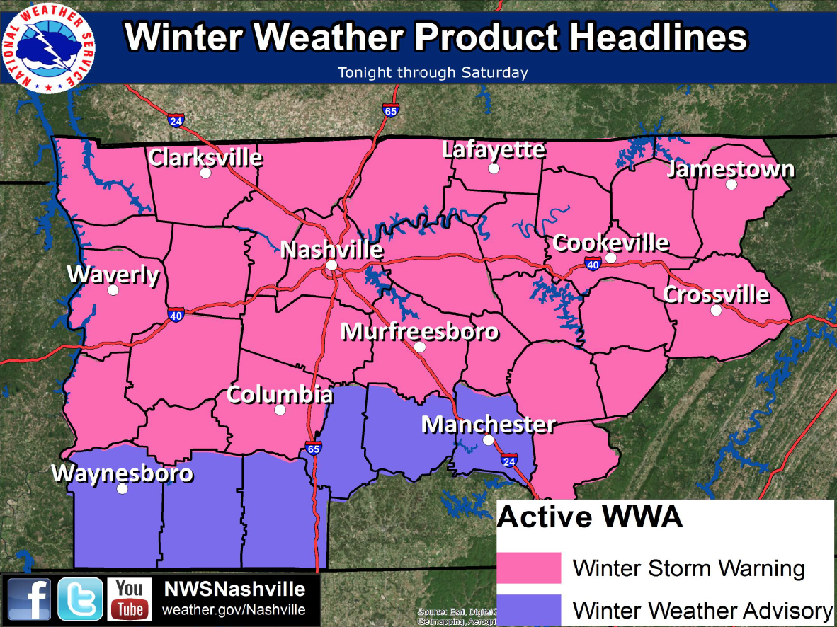
Summary: WINTER STORM WARNING 6am Friday to 6am Saturday. 3 to 5 inches expected. Changeover from rain to snow expected between 6am and noon.
IMPORTANT: This event is just shaping up, with new info coming out every hour. I will be updating this post likely several times between now and the end of it.
DISCLAIMER: Forecasting winter weather is difficult, even more so in Middle Tennessee. I’m proving the best info I can here, but please be mindful that things can and likely will change.
Also, stick to trusted weather sources, not word-of-mouth, when it comes to expected snow accumulations. All of our info is coming straight from NWSNashville, those tasked with the job to forecast the weather and tell all of us.
We’re starting to see the moisture from our next winter weather system move in now in the form of rain.
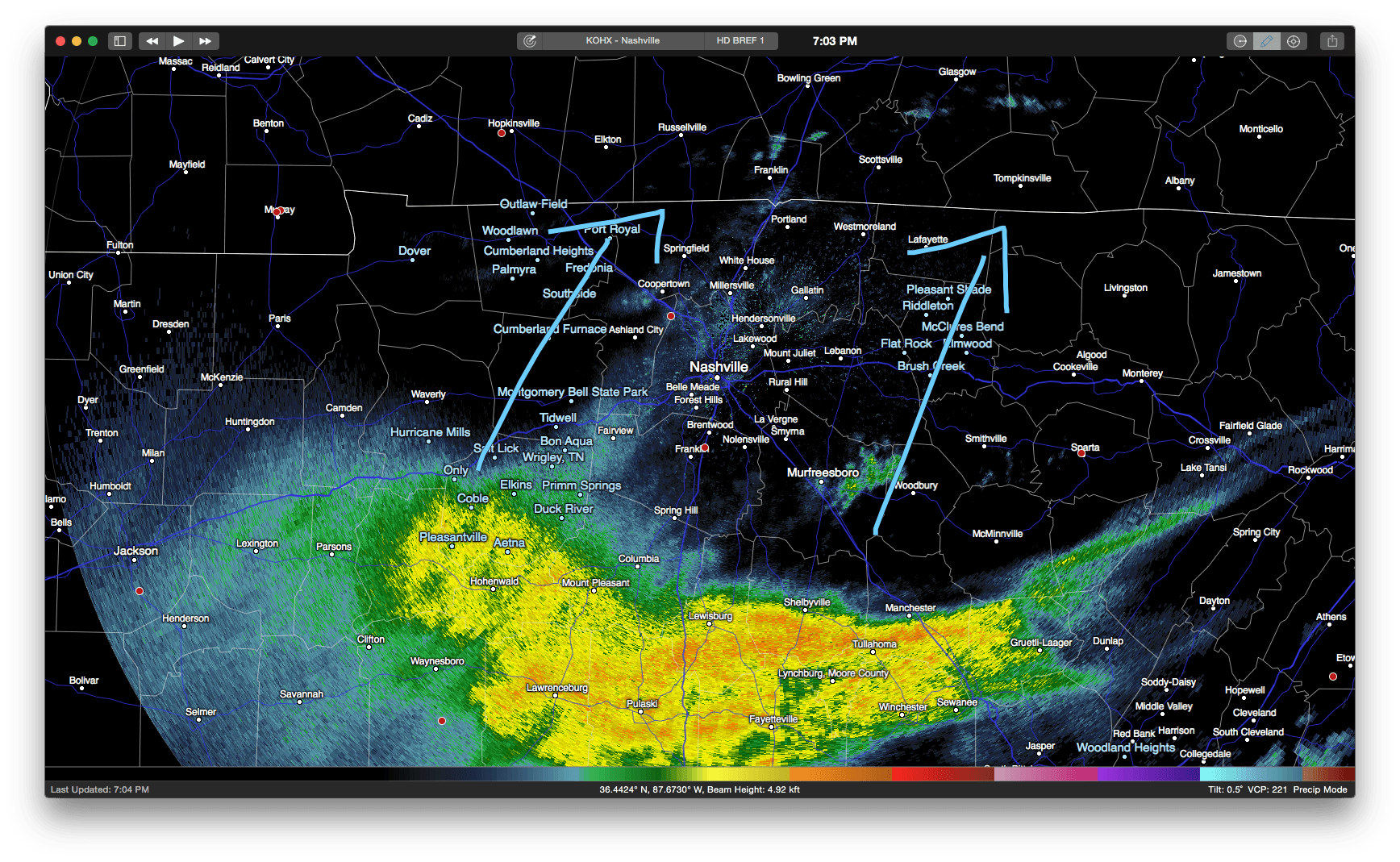
This system is going to bring with it rain in the beginning, then quickly change to snow as the system moves out and we start feeling the cold air move in behind it. Because of this, NWSNashville has us under a WINTER STORM WARNING from 6am Friday to 6am Saturday.
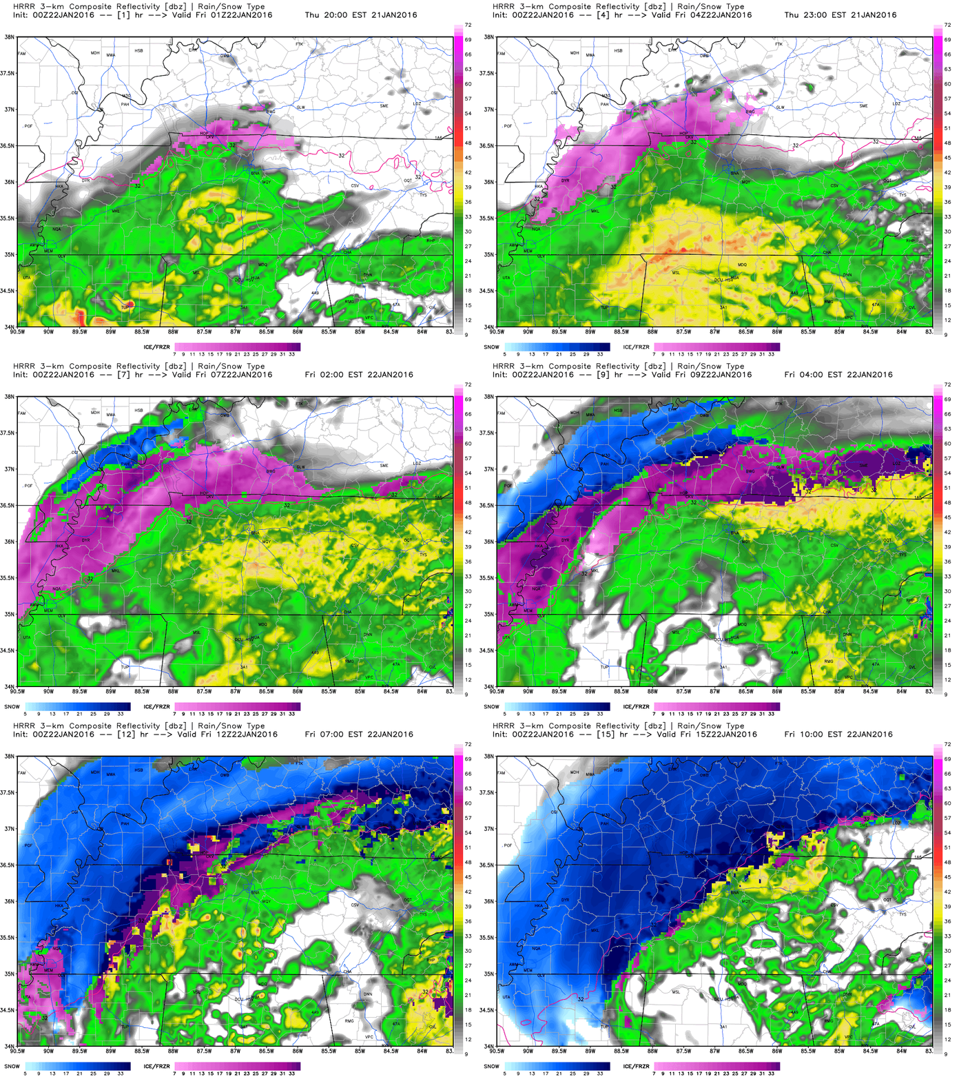
Here’s what the HRRR currently forecasts for us in terms of the rain headed our way and when it thinks the changeover is going to happen. This is the HRRR simulated radar.
In terms of timing of the system, here are timing graphics provided by NWSNashville (as of 7pm 1/21).
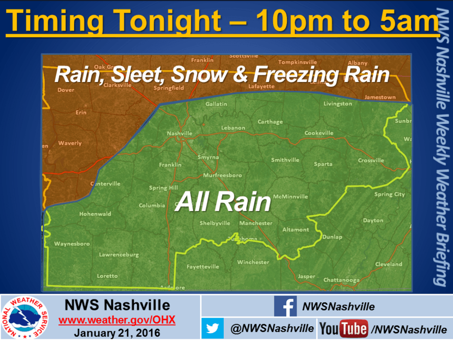
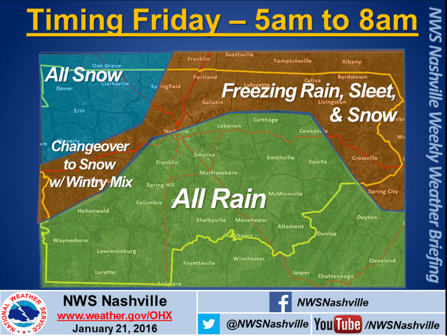
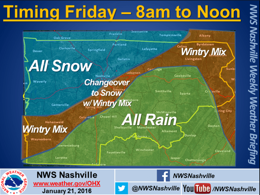
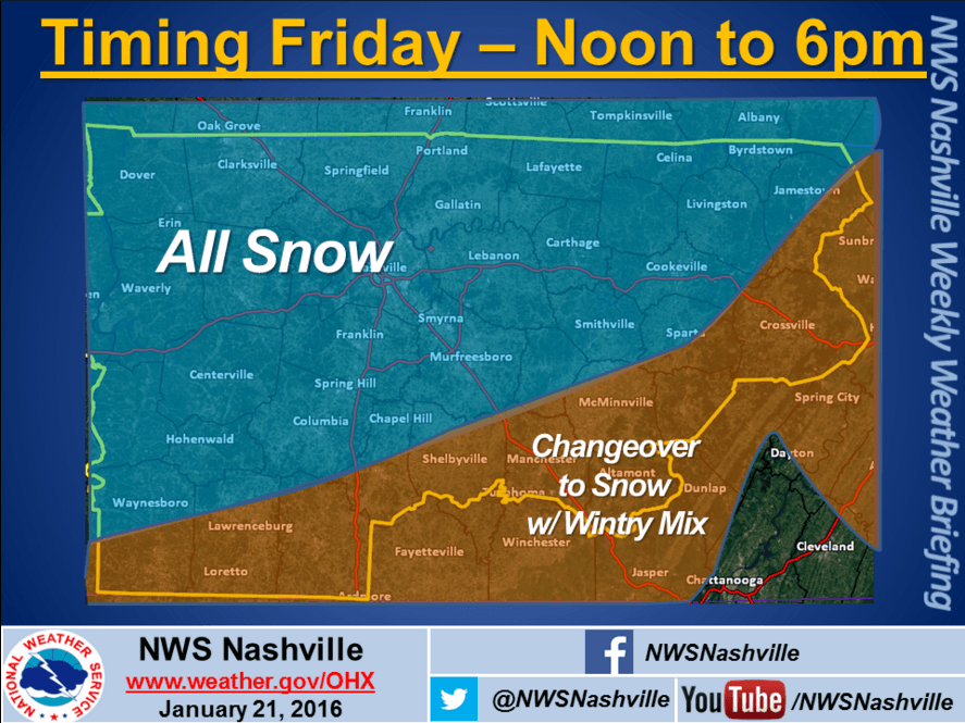
These are updated graphics issued within the last couple of hours to reflect model trends.
What are the models saying right now in terms of when we could start seeing the changeover from rain to frozen precip?
The HRRR above is saying 7am for Northwest Hickman County, 8am for Southeast Hickman County.
The NAM4 is saying 9am for Northwest Hickman County, 10am for Southeast Hickman County.
And here’s what NWSNashville is estimating for snow accumulations (we’ll talk more about this later in the post). NWSNashville anticipates Hickman County receiving about 3-5 inches of snow.
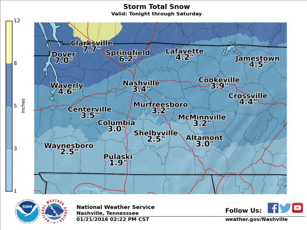
Important: I understand there are likely some snow total maps floating around the Web in terms of how much snow we are going to get. Even models push out different information.
When it comes to models, “snow accumulation” and “snow depth” are two different things. What we’re looking for is “snow depth,” or the amount of snow on the ground at any given time. The model images below are “snow depth” images.
Here’s what the GFS has as snow depth at 6am Saturday morning (the peak of the snow depth).
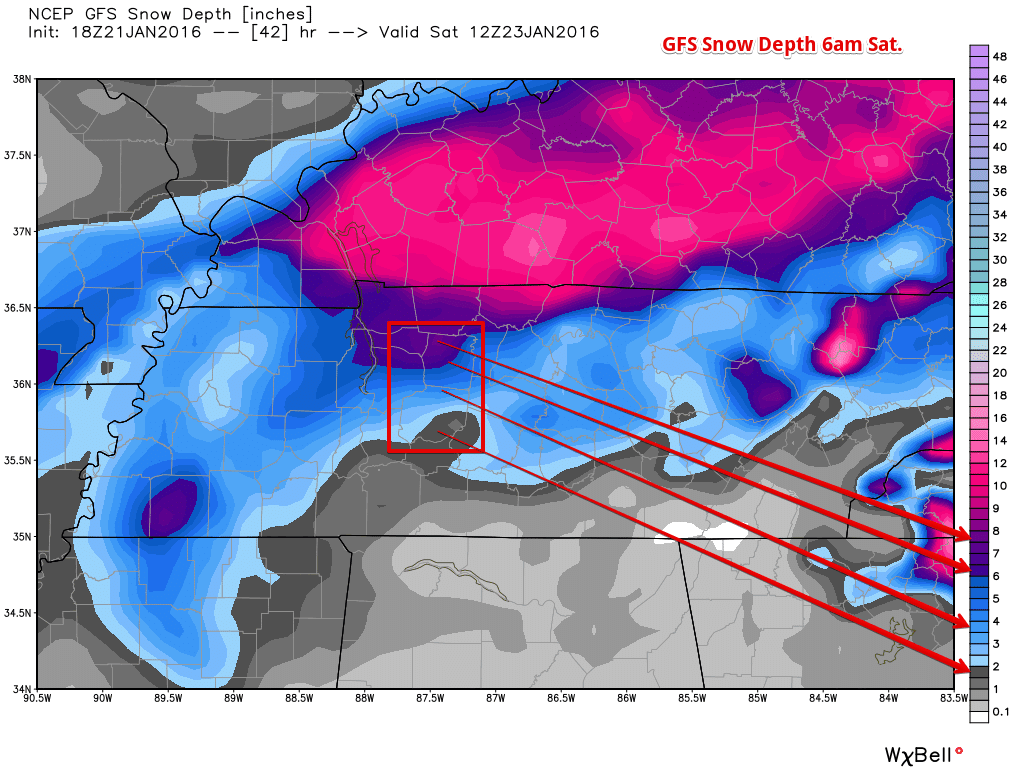
Notice that Hickman County has a very sharp gradient the further south you go. Northern parts of the county will see more snow (2-4 inches) while the Southern parts of the county will see less snow (1-2 inches).
NAM4 is saying pretty much the same thing, and holding on to the same gradient from north to south as the GFS has (click the image to make it bigger).
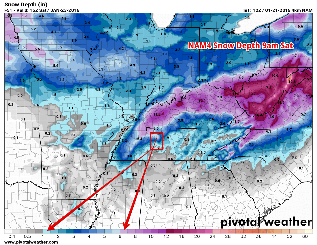
The current trend is that we believe the changeover is going to happen sooner than we thought earlier today. Earlier today we thought the changeover would happen around lunch time. Now it looks to be mid morning.
Watch the radar if you’re commuting tomorrow and be aware of the conditions. This will start accumulating shortly after falling, and will start as freezing rain first, putting a thin layer of ice down.
We’ll update this site as needed. Our Twitter will have the latest info as always.